Wu Kang | Radar System Specialist | Updated August 21, 2026
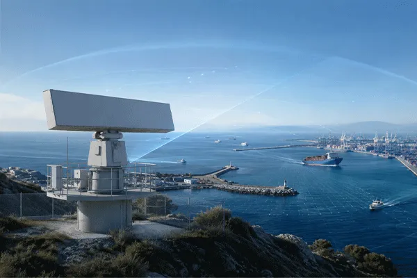
Yüzey gözetleme radarı tracks vessels along coastlines and in port approaches using X-band or Ku-band beams that separate moving hulls from sea clutter. Midradar’s RDG series documents vessel-detection ranges from roughly 3 km up to 50 km depending on model and vessel size, with wave and weather clutter suppression built into the signal processing chain.
Surface Surveillance Radar: Detecting Vessels Up to 50km
What Surface Surveillance Radar Actually Tracks
A surface surveillance radar scans a coastline or port approach and reports vessel tracks — position, heading, speed — by filtering moving hulls out of a background that includes waves, rain, and passing traffic on shore. The harder engineering problem isn’t detecting a large cargo ship; it’s holding onto a small boat in a rough sea state without either losing the track or flooding the operator with false alarms from wave crests.
Midradar builds the RDG series around that distinction. Rather than one range figure, each model publishes separate numbers for “large vessel / general,” “vehicle / small boat,” and, on several models, personnel — because a coastal security radar is frequently protecting a road or fence line alongside the water, not just open sea. Across Midradar’s deployed base, this line has been used in projects spanning more than 1,000 km of border and coastline, which is the scale this section-by-section range data is meant to support.
How the RDG Series Separates Vessels from Sea Clutter
The X-band models (RDG50K, RDG20K, RDG07K, RDG06K) use 1-D AESA architecture; the Ku-band models (RDG03K, RDG03-4R) use digital beamforming. Both avoid mechanical antenna rotation, which is part of what keeps the refresh rate fast enough to hold a track on a fast-moving small boat.
Two processing stages matter specifically for maritime targets:
- Adaptive clutter suppression filters recurring wave and weather returns before they reach the tracking stage — this is the difference between a system that reports every whitecap as a contact and one that doesn’t.
- Track-before-detect (TBD) correlates weak returns across multiple scans, which is what keeps a low-RCS target like a rigid-hull inflatable boat (RHIB) from disappearing between sweeps in choppy conditions.
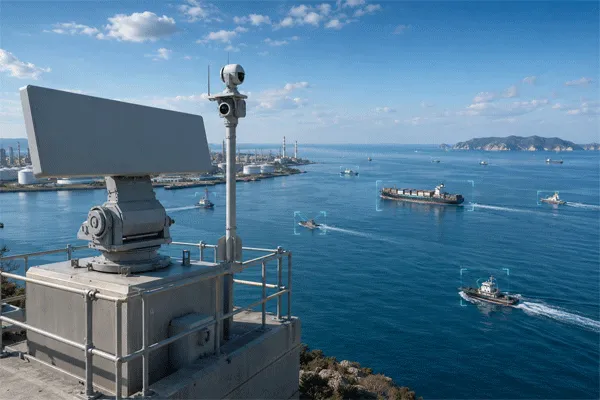
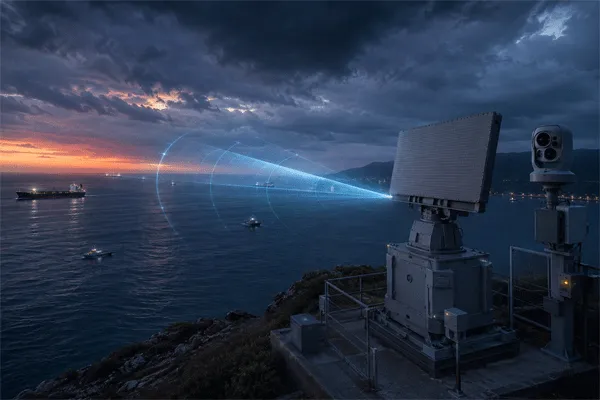
Radar-EO slew-to-cue — handing a confirmed track’s bearing to an electro-optical camera — is a common pairing in port and coastal deployments, letting an operator get visual confirmation of a contact instead of working from a radar blip alone. That’s a system design choice built on top of the radar, not a radar-only capability.
Vessel Detection Range, Model by Model
| Model |
Band / Architecture |
Large Vessel / General |
Vehicle / Small Boat |
Personel |
| MR-RDG50K |
X-band, 1-D AESA |
≥50 km |
≥25 km |
≥15 km |
| MR-RDG20K |
X-band, 1-D AESA |
≥25 km |
≥15 km |
≥10 km |
| MR-RDG07K |
X-band AESA, 9.55–9.75 GHz |
≥25 km (RCS 10 m²) |
≥15 km (RCS 5 m²) |
≥10 km (RCS 0.5 m²) |
| MR-RDG06K |
X-band, compact 1-D AESA |
≥16 km |
≥8 km |
≥5 km |
| MR-RDG03K |
Ku-band, DBF multibeam |
≥10 km |
≥6 km |
≥3 km |
| MR-RDG03-4R |
Ku-band, 4-face DBF |
≥10 km |
≥6 km |
≥3 km |
The MR-RDG07K is the only model in the line that states the radar cross-section behind each figure — 10 m² for large vessel, 5 m² for small boat, 0.5 m² for personnel. The other five models publish the same category labels without an RCS figure attached, so a “≥50 km” or “≥16 km” rating should be read as the manufacturer’s reference target, not a guarantee for every hull size you’ll actually see on the water.

Surface Surveillance Radar: Detecting Vessels Up to 50km
Accuracy, Refresh Rate and Ratings for Coastal Sites
| Model |
Menzil Doğruluğu |
Açı Doğruluğu |
Track Capacity |
Refresh |
Güç |
IP Rating |
| MR-RDG50K |
≤5 m |
≤0.25° |
≥200 |
Not published |
≤200 W |
IP67 |
| MR-RDG20K |
≤5 m |
≤0,4° |
≥200 |
Not published |
≤140 W |
IP67 |
| MR-RDG07K |
≤5 m |
≤0,4° |
≥200 |
Not published |
20 W transmit / ≤140 W total |
IP67 |
| MR-RDG06K |
Not published |
Not published |
Not published |
Not published |
≤75 W |
IP67 |
| MR-RDG03K |
Not published |
Not published |
≥100 |
≤0.25 s / 4 Hz |
≤85 W |
IP67 |
| MR-RDG03-4R |
Not published |
Not published |
Not published |
≤0.25 s / 4 Hz |
Not published |
Not published |
All six models share a company-wide -40°C to +55°C operating range, which matters for coastal masts exposed to salt air and temperature swings between an open-water winter and a coastal summer. The MR-RDG06K additionally publishes a blind zone of ≤50 m — a figure the other five models don’t disclose, and one worth asking about directly if your mast sits close to a berth or jetty where near-field coverage matters as much as long range.
Matching a Model to Port or Coastline Length
- Measure the actual coverage distance you need, not the theoretical max — a 25 km-rated radar covering a 10 km stretch of coastline has margin for weather degradation; one rated exactly to your requirement doesn’t.
- Decide which target class drives the spec.If small-boat and RHIB detection near a port entrance is the real requirement, filter on the vehicle/small-boat column rather than the large-vessel figure most vendors lead with.
- Check whether personnel or shoreline vehicle detection is also in scope.Several RDG models publish a personnel range alongside vessel range, which can cover a combined water-and-shore security requirement from one mast.
- Confirm refresh rate against vessel speed.The Ku-band models publish a 4 Hz refresh; the X-band models don’t state one publicly, so ask directly if you’re tracking fast craft.
- Request the RCS assumption for your modelif it isn’t the MR-RDG07K — without it, a published range figure is a reference point, not a spec you can hold a vendor to.
A Common Mistake: Treating “Vessel Range” as One Number
Coastal security bids often shortlist radar on a single advertised range without asking what size vessel that range assumes. The MR-RDG07K’s published figures show why this matters within one product line alone: the same radar detects a 10 m² target at 25 km but only detects a 0.5 m² target — closer to a person or a small craft’s radar signature — at 10 km. A radar that looks identical to a competitor’s on a headline spec sheet can perform very differently once you specify the actual RCS of what you’re trying to catch.
This isn’t unique to Midradar’s line. Coastal radar engineering literature notes that <cite index=”17-1″>low-RCS targets such as swimmers, unmanned surface vehicles, and rigid-hull inflatable boats are a known detection challenge for conventional surveillance radar</cite> generally, and that <cite index=”13-1″>coastal installations typically use antennas shaped to reduce the blind zone that commonly occurs on elevated mounting sites</cite>. Neither point is specific to one vendor — they’re reasons to ask for the RCS assumption and blind-zone figure on any coastal radar you’re evaluating, not just Midradar’s.
Surface Surveillance Radar: Detecting Vessels Up to 50km
How This Compares with Wide-Area Maritime Search Radar
Some maritime radar marketing pages advertise ranges far beyond the RDG series — one coastal surveillance system markets <cite index=”12-1″>a horizontal detection range up to 96 nautical miles, covering roughly 98,000 square kilometers of situational awareness from a single unit</cite>, and a separate wide-area search radar lists <cite index=”20-1″>search ranges up to 100 nautical miles with multimode SAR and weather-radar functions</cite>. Those figures — 96 and 100 nautical miles work out to roughly 178 km and 185 km — describe a different equipment class: higher-power, open-ocean search and air-surface radar built for naval or wide-EEZ patrol missions, not the compact single-mast units this line is built for. For port perimeters, harbor approaches, and coastline stretches measured in single-digit to low double-digit kilometers, the RDG series’ per-target-type range breakdown is the more directly usable comparison point than a nautical-mile figure built for a different mission profile.
Integration with Port and Coastal Security Platforms
RDG-series radars connect through GB/T 28181 and ONVIF for video and security-platform integration, RTSP for streaming, and RESTful APIs and SDKs for custom software work. For a port or coastal command center, the practical question is which data fields — vessel track ID, classification, GPS position — your existing platform ingests from the radar feed, and that’s worth confirming with both the platform vendor and Midradar before finalizing an integration spec, since GB/T 28181 and ONVIF compliance on paper doesn’t guarantee every field maps cleanly on the first pass.
Trade-offs Worth Weighing
The RDG line’s advantage for coastal work is the per-target-type breakdown and, on the MR-RDG07K, an explicit RCS figure most competing spec sheets don’t publish at all. The gap is that only three of the six models (RDG50K, RDG20K, RDG07K) publish range and angle accuracy, refresh rate isn’t stated for any X-band model, and blind zone is published for exactly one model in the line. None of that rules a model out — it means the numbers your bid needs but the public datasheet doesn’t have should come from a direct request before the spec goes into a proposal, not from an assumption that all six models share the same undisclosed figures.
SSS
What vessel size does the "50 km" range on the MR-RDG50K assume?
Midradar's public datasheet doesn't state an RCS figure for the MR-RDG50K's large-vessel range. Only the MR-RDG07K publishes RCS assumptions (10 m² / 5 m² / 0.5 m²) alongside its range figures — request the equivalent figure for other models before using their range in a bid.
Can these radars distinguish a small boat from a swimmer or debris?
Classification is handled through track-before-detect processing and, in most deployments, EO camera confirmation via slew-to-cue rather than the radar alone. Low-RCS targets like swimmers and small unmanned craft remain a general challenge for coastal radar, not something any single spec figure fully resolves.
Do I need multiple units to cover a long coastline?
Yes, for coverage beyond one radar's range and azimuth footprint. Coastline length, not just range, should drive the count — match your total distance against the per-model range table rather than assuming one unit's rated range covers your full site.
How does this compare with naval-grade maritime search radar?
Wide-area search radars used for open-ocean or EEZ patrol publish ranges in the 90–100 nautical mile range (roughly 165–185 km), but they're a different equipment class built for that mission. For port and coastline security at single-digit to low double-digit kilometer distances, the RDG series' target-type breakdown is the more relevant comparison.
What certifications back this product line?
ISO 9001:2015 quality management certification, CE marking, and National High-Tech Enterprise designation, all at the company level. Per-model certificate numbers aren't published on the RDG series' public pages.



 10:45
10:45